Portal:THESEUS/Scheldt estuary
The Western Scheldt estuary is located in the SW of the Netherlands, connecting the Scheldt River in Belgium with the North Sea coast of the Netherlands. Along the Western Scheldt, the land is protected by strong dikes, as much of this land is laying well below sea level.
The Western Scheldt is of major economic importance, as it provides the navigation channel for the harbour of Antwerp, which is essential for the Belgium economy. Maintaining the shipping channel requires major and continuous dredging operations. Moreover, the growth of container vessels also requires dredging to increase the overall depth of the shipping. This continuous deepening of the shipping channel has major influence on the tidal water movement through the Western Scheldt, and has resulted in increased current velocities as well as increased tidal amplitude. It is still matter of discussion if the tidal asymmetry may have changed. It is however clear that due to ongoing dredging and deepening, the risk of flooding of urban and industrial areas along the Western Scheldt is strongly increasing.
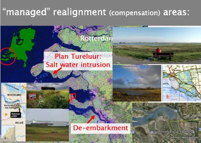
Apart from being highly economically important, the Western Scheldt is also of high ecological importance. The sediment budget of the Western Scheldt estuary is heavily influenced by what happens in the Belgian coastal area (and vice versa), in particular in the area around the turbidity maximum (Zeebrugge harbor). The Western Scheldt itself is a multi channel system with several tidal flats both in the middle and along the edges of the estuary. These tidal flats are inhabited by a rich diversity of benthic organisms, on which migratory birds feed. At higher elevations are tidal marshes with an unique vegetation. The biology in these areas are governed by a combination of an elevational (flooding) gradient and a salinity gradient. Whereas the mouth of the Western Scheldt is saline, more inland the estuary becomes more brackish due to the influence of the Scheldt river. This salinity gradient has a major influence of the benthos composition of the tidal flats and the vegetation composition at the tidal marshes. Nearby Antwerp, is the Verdronken land of Saeftinge, which is the largest remaining brackish tidal marsh of the whole of Europe. Because of its unique ecological value, the nature in the Western Scheldt is legally highly protected, thereby putting constraints on the economic development of the harbour of Antwerp. Loss of intertidal nature areas need to be compensated for by construction of new tidal areas. This has lead to many conflicts with the local population whom is concerned about the flooding risk, still remembering the major flooding event in 1953.
On the one hand, increasing sea-level rise combined with the effect of deepening of the Scheldt on tidal amplitude, makes that maintaining a proper coastal defense along the Western Scheldt is essential for the safety of the people living in this estuary. On the other hand, economic growth requires measures that have a negative impact on safety (dredging) and ecology (dredging and harbour extensions). Although the legally required compensation measures may be perceived as a threat to safety, it may in fact offer an opportunity to enhance safety by integration of nature into coastal defense. Thus, knowledge on the proper integration of nature into coastal defense would be highly beneficial to this area, as it meets 3 objectives: enhancing safety, allowing continuous economic growth and maintaining the ecological values of this estuary. This makes the Western Scheldt an ideal estuary to design and test mitigation technologies that can both improve the safety and economic development of coastal areas. At this moment, integrating salt marshes into the coastal protection seems to be the most promising approach, and the available saltmarshes that strongly differ in their state of health offer excellent opportunity to study this topic.


