File:SwashWaterTable.jpg
From Coastal Wiki
Revision as of 16:23, 13 March 2025 by Dronkers J (talk | contribs) (Left: Beach of Belongil (Australia, Google Earth image). Right: Horizontal variation of the groundwater table intersection with the beach face (exit level, red line) in response to swash excursions (blue line) measured on the beach of Belongil. Figure...)
Size of this preview: 800 × 246 pixels. Other resolutions: 320 × 99 pixels | 3,765 × 1,159 pixels.
Original file (3,765 × 1,159 pixels, file size: 412 KB, MIME type: image/jpeg)
Summary
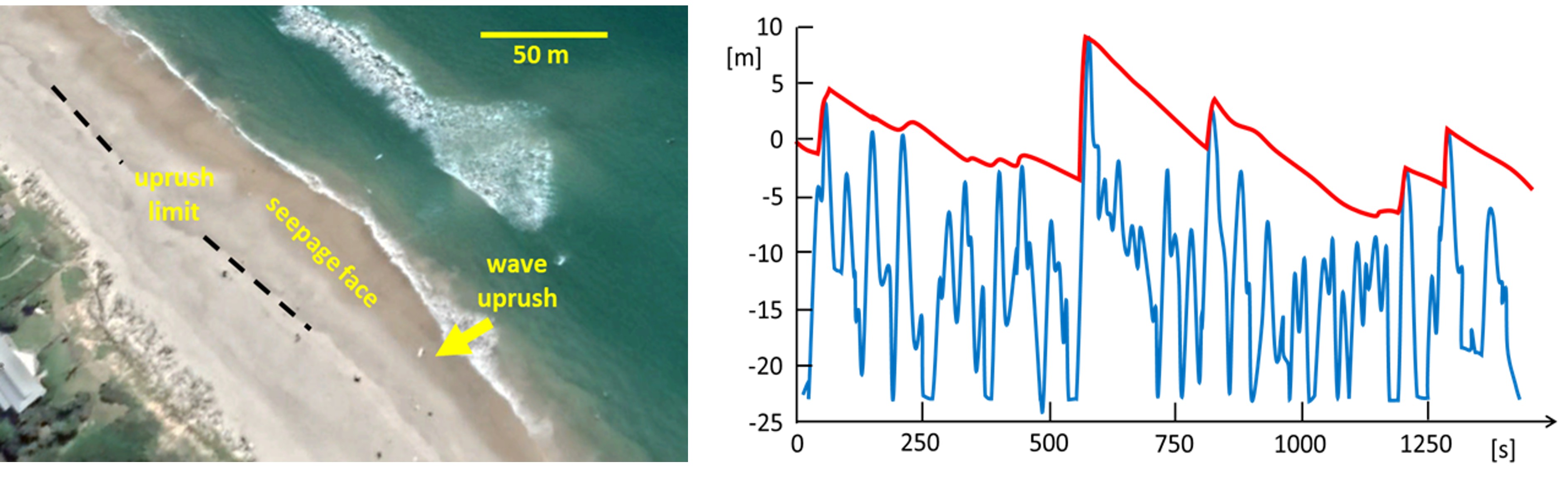
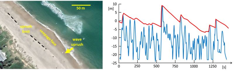
Left: Beach of Belongil (Australia, Google Earth image). Right: Horizontal variation of the groundwater table intersection with the beach face (exit level, red line) in response to swash excursions (blue line) measured on the beach of Belongil. Figure redrawn from Cartwright et al. (2006[1]).- ↑ Cartwright, N., Baldock, T.E., Nielsen, P., Jeng, D-S. and Tao, L. 2006. Swash-aquifer interaction in the vicinity of the water table exit point on a sandy beach. J. Geophys. Res. 111, C09035
File history
Click on a date/time to view the file as it appeared at that time.
| Date/Time | Thumbnail | Dimensions | User | Comment | |
|---|---|---|---|---|---|
| current | 16:23, 13 March 2025 | 3,765 × 1,159 (412 KB) | Dronkers J (talk | contribs) | Left: Beach of Belongil (Australia, Google Earth image). Right: Horizontal variation of the groundwater table intersection with the beach face (exit level, red line) in response to swash excursions (blue line) measured on the beach of Belongil. Figure... |
- You cannot overwrite this file.
File usage
The following page links to this file:
