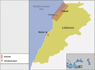
North Lebanon Coastal Zone
CASE description
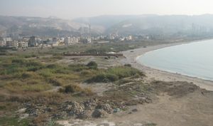
The Northern coastline constitutes approximately 37% of the total Lebanese coast with 102.5 Km of shoreline length. It includes three bays and two main headlands and a variety of river deltas as well as the Palm Island Nature Reserve. The coast is sandy/pebbly (51% of the total Northern coast) and rocky (49% of the total Northern coast).
ICZM phase
Main coastal issues
- Urban sprawl
- Erosion
- Marine pollution
- Transport
- Impacts on fishery
Objectives
- To mitigate coastal risk
- To improve urban sprawl and fishery resources management
End Products
Reports on conservation and particular relevant coastal issues (coastal dynamics and pollution, urban sprawl and artificialiation, erosion, accretion and sea filling)
Tools foreseen to be developed and used
Indicators - LEAC - Economic Assessment - Modelling about pollution and sediment transport - Scenarios - Participatory methods
Other tools to be applied
Early warning system
Training needs
LEAC - Applied coastal physical oceanography indicators - Pollution transport - Early warning system
CASE Responsibles
Manale Abou Dagher, Manal R. Nader, University of Balamnd, manal.aboudagher@balamand.edu.lb, Manal.nader@balamand.edu.lb
Elaboration: Stefano Soriani, Fabrizia Buono, Monica Camuffo, Marco Tonino, University Ca’ Foscari of Venice.


