Unused files
The following files exist but are not embedded in any page. Please note that other web sites may link to a file with a direct URL, and so may still be listed here despite being in active use.
Showing below up to 50 results in range #51 to #100.
View (previous 50 | next 50) (20 | 50 | 100 | 250 | 500)
- Barrier coast.jpg 561 × 1,104; 116 KB
- Mangrove coast.jpg 703 × 519; 37 KB
- Littoral table.jpg 1,112 × 355; 77 KB
- Exposed cliff1.jpg 726 × 563; 76 KB
- Exposed cliff2.jpg 768 × 600; 50 KB
- Monsoon1.jpg 726 × 521; 57 KB
- Monsoon2.jpg 768 × 600; 49 KB
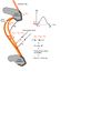
- Drift budget.jpg 852 × 1,087; 83 KB
- Exposed dune1.jpg 845 × 596; 58 KB
- Exposed dune2.jpg 768 × 600; 49 KB
- Increasing littoral drift rate.jpg 1,186 × 674; 144 KB
- Relation transport angle.jpg 1,890 × 1,096; 67 KB
- Detatched breakwater the one before.jpg 1,572 × 1,068; 82 KB
- Natural delta accretion.jpg 2,127 × 1,668; 140 KB
- Crescent correlation.jpg 1,275 × 1,534; 76 KB
- Detatched breakwater.jpg 2,025 × 1,419; 124 KB
- Initial sed trans the one before.jpg 1,018 × 708; 63 KB
- Initial sed trans.jpg 990 × 708; 50 KB
- Shoreline development schematic new.jpg 921 × 615; 59 KB
- Eutrophicationflow.jpg 809 × 70; 9 KB
- Koncept.jpg 512 × 528; 94 KB
- Backshore nourishment.jpg 867 × 948; 46 KB
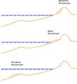
- Nourishment methods.jpg 441 × 305; 24 KB
- Beach drain fn.jpg 596 × 232; 42 KB
- Bds.jpg 450 × 193; 11 KB
- Slap-ton2.jpg 250 × 203; 22 KB
- Slapton2.jpg 1,139 × 653; 61 KB
- Overtopping.jpg 645 × 811; 80 KB
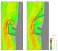
- Lee circulation a.jpg 1,013 × 710; 85 KB
- Lee circulation b.jpg 873 × 764; 130 KB
- Irregular storm.jpg 720 × 511; 59 KB
- Durationexceedence.jpg 418 × 258; 28 KB
- Waverose.jpg 365 × 259; 10 KB
- Scatter.jpg 434 × 238; 16 KB
- MIUoP.jpg 330 × 64; 7 KB
- SMPboundaries.jpg 403 × 303; 19 KB
- Drift budget b.jpg 852 × 1,087; 91 KB
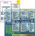
- Theme10 Flowchart StellaVallejo.jpg 960 × 720; 67 KB
- Shoreline development groyne.jpg 556 × 672; 63 KB
- Scheme.jpg 323 × 255; 28 KB
- Scheme2.jpg 323 × 255; 28 KB
- Fig.jpg 516 × 393; 35 KB
- Fig3 flexible mesh.jpg 520 × 443; 45 KB
- Fig5 San Stafano.jpg 440 × 324; 19 KB
- Fig6 wave modelling.jpg 464 × 338; 15 KB
- Fig7 sed trans pattern.jpg 440 × 230; 32 KB
- Fig8 current pattern.jpg 440 × 233; 24 KB
- Fig9 amager beach.jpg 556 × 566; 84 KB
- Fig10 wave patterns NE and SE.jpg 439 × 929; 80 KB
- Fig11 Amager Beach Park aerial photo.jpg 379 × 281; 15 KB


