File list
This special page shows all uploaded files.
| Date | Name | Thumbnail | Size | User | Description | Versions |
|---|---|---|---|---|---|---|
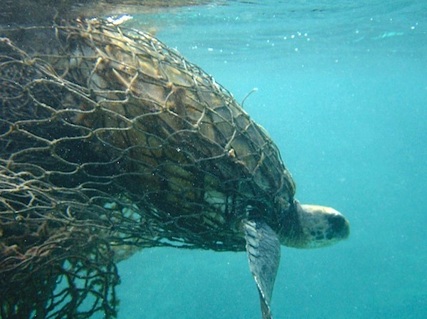
| 19:45, 10 September 2024 | EntangledTurtle.jpg (file) |  |
73 KB | Dronkers J | A green sea turtle is entangled in an abandoned fishing net. Image courtesy of Doug Helton, NOAA. Wikimedia commons | 1 |
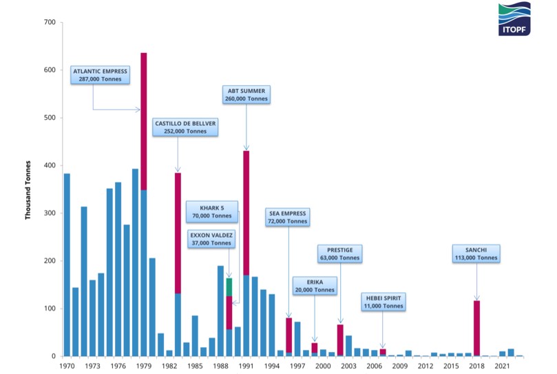
| 22:14, 5 September 2024 | TankerSpillStats23.jpg (file) |  |
53 KB | Dronkers J | Quantities of oil spilled from tanker incidents 1970-2023. From ITOPF website https://www.itopf.org/knowledge-resources/data-statistics/statistics/ | 1 |
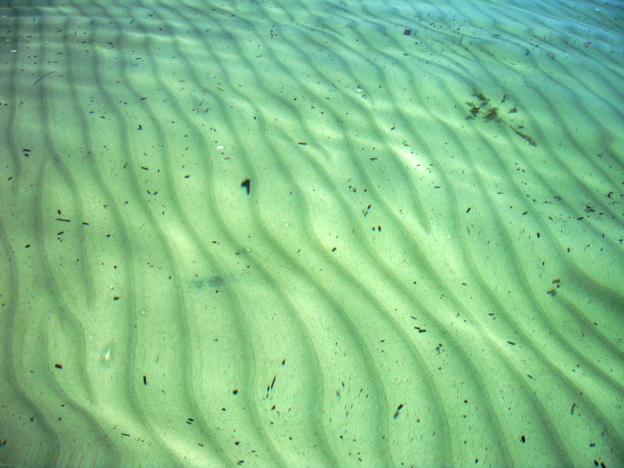
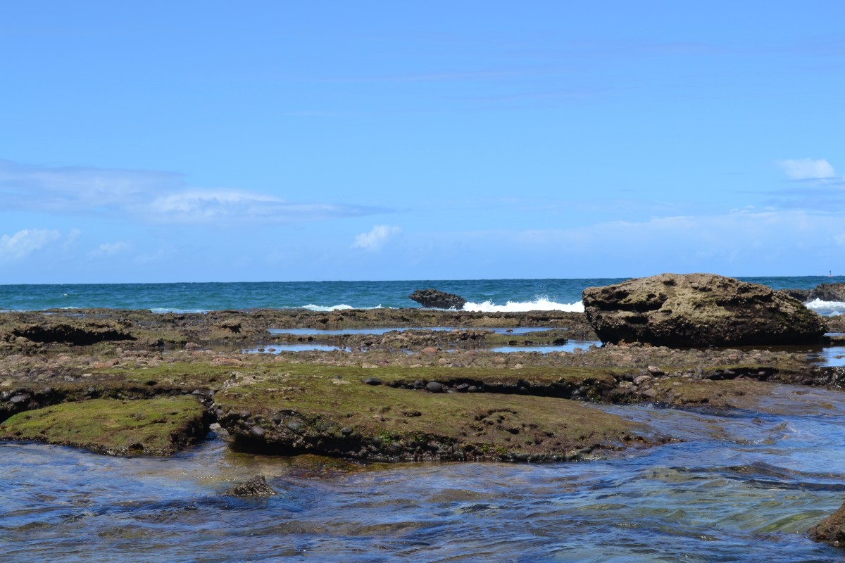
| 10:08, 31 August 2024 | SeabedRipples.jpg (file) |  |
377 KB | Dronkers J | Seabed ripples. Photo credit Julia Harwood. | 1 |
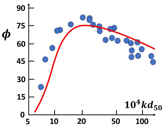
| 13:31, 30 August 2024 | PhaseLead.jpg (file) |  |
35 KB | Dronkers J | The phase lead angle <math>\phi</math> of the bed shear stress relative to the bed perturbation as a function of <math>k \, d_{50}</math>. Figure adapted from Charru et al. (2013<ref name=C13/>). | 2 |
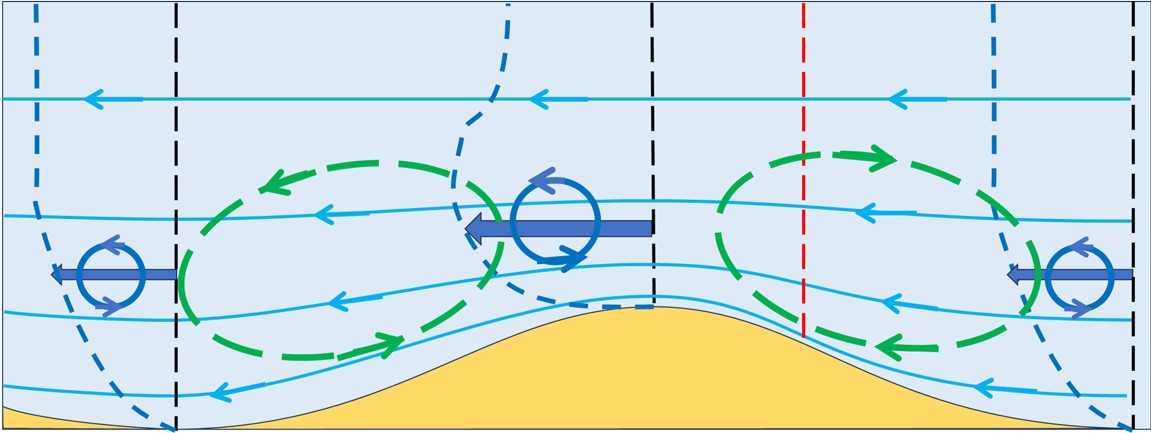
| 20:02, 22 August 2024 | Bedform7.jpg (file) |  |
37 KB | Dronkers J | If oscillating flow is assumed to be equivalent to successive periods of steady flow from the right and from the left, then the net resulting flow pattern consists of circulation cells that move sediment grains from the troughs to the crests. | 1 |
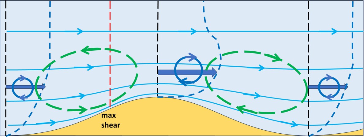
| 20:00, 22 August 2024 | Bedform6.jpg (file) |  |
82 KB | Dronkers J | Flow pattern adjusted to a bed perturbation similar as in Fig. 5, but with the flow direction reversed. | 1 |
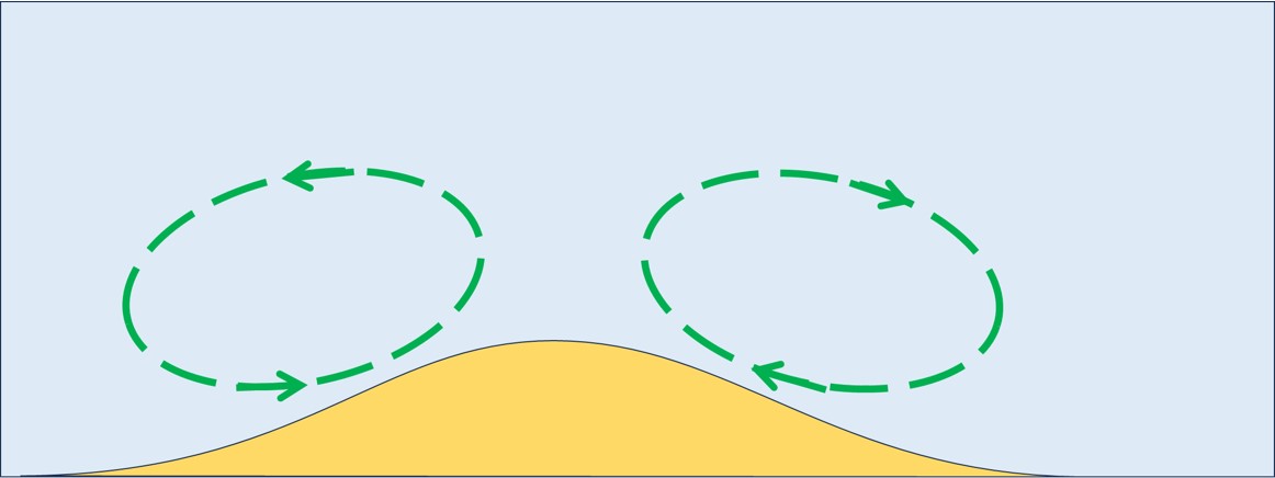
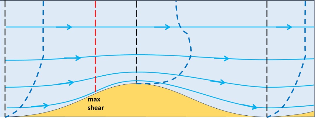
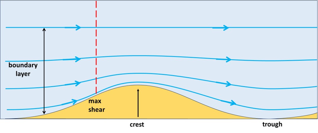
| 19:58, 22 August 2024 | Bedform5.jpg (file) |  |
90 KB | Dronkers J | The negative vorticity balance on the upstream side of the ripple drives a counterclockwise circulation, while the positive balance on the downstream side drives a clockwise circulation. | 1 |
| 19:29, 22 August 2024 | Bedform4.jpg (file) |  |
78 KB | Dronkers J | Transport of vorticity (rotational component of velocity) at the ripple trough and ripple crest. | 1 |
| 19:29, 22 August 2024 | Bedform3.jpg (file) |  |
60 KB | Dronkers J | The velocity profiles at the ripple trough and the ripple crest corresponding to the contraction-divergence of the streamlines. | 1 |
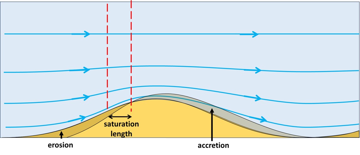
| 19:27, 22 August 2024 | Bedform2.jpg (file) |  |
63 KB | Dronkers J | The emerging ripple is eroded where the shear stress increases due to contraction of the streamline toward the sediment bed. Accretion occurs where streamlines diverge from the sediment bed. The erosion-accretion boundary is shifted by the saturation l... | 1 |
| 19:26, 22 August 2024 | Bedform1.jpg (file) |  |
52 KB | Dronkers J | Steady flow streamlines over an emerging bed ripple in a vertical longitudinal section. | 1 |
| 11:17, 12 August 2024 | WaveAngles.jpg (file) |  |
105 KB | Dronkers J | Wave incidence angles in a 1-line model where the breaker contour line is parallel to the shoreline. | 2 |
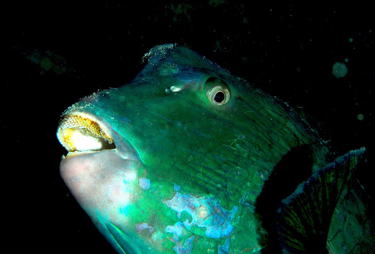
| 11:18, 9 August 2024 | BumpheadParrotfish JennyHuang.jpg (file) |  |
120 KB | Dronkers J | Bumphead parrotfish. Parrotfish contribute to bioerosion by rasping algae from coral and other rocky substrates with their teeth tightly packed on the external surface of their jaw bones. For example, parrotfish grazing accounted for the production of... | 1 |
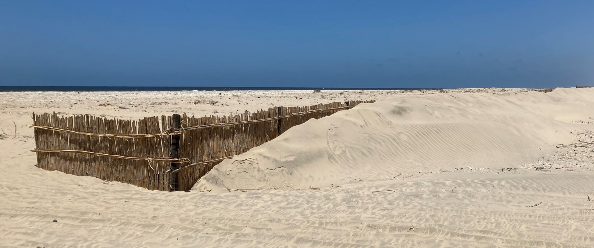
| 20:39, 3 August 2024 | NileDeltaDuneFences.jpg (file) |  |
270 KB | Dronkers J | Dune development with sand fences for coastal protection (Egypt, 2022). Green Climate Fund project “Enhancing Climate Change Adaptation in the North Coast and Nile Delta Regions”. | 1 |
| 17:00, 3 August 2024 | ChadwickFig2a.jpg (file) |  |
175 KB | Dronkers J | Wave transformations at Bigbury bay, Devon, England. Photograph courtesy of Dr S M White. | 2 |
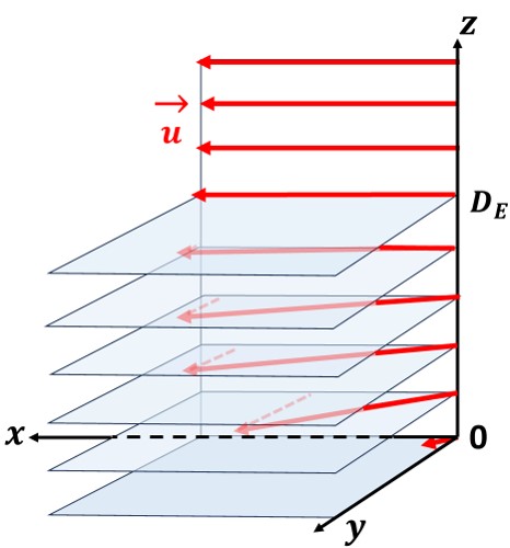
| 20:15, 21 June 2024 | EkmanBottomLayer.jpg (file) |  |
37 KB | Dronkers J | Velocity veering in the Ekman bottom layer. | 1 |
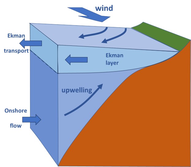
| 14:38, 20 June 2024 | EkmanTransport.jpg (file) | 34 KB | Dronkers J | EkmanTransport.jpg Alongshore wind (coast at the left in the Northern hemisphere) produces offshore Ekman transport in the upper Ekman layer. This offshore transport is compensated by onshore flow at depth and upwelling. | 1 | |
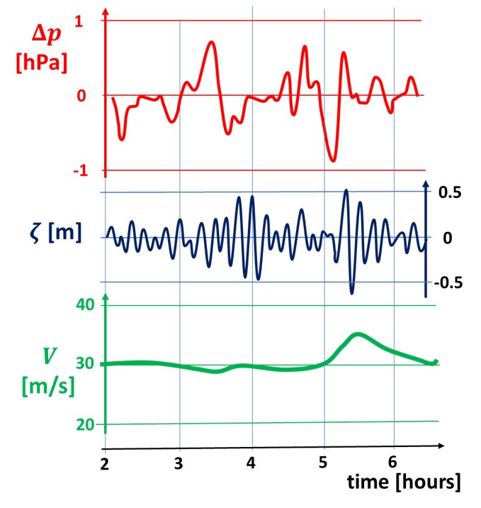
| 16:02, 16 June 2024 | MeteotsunamisCiutadella.jpg (file) |  |
73 KB | Dronkers J | Meteo tsunami at Ciutadella (Menorca,Spain) on 15 September 2021. Red curve = atmospheric pressure perturbation, blue curve = harbor oscillation Ciutadella, green curve = mid-troposphese wind speed. Redrawn from Villalonga et al. (2024<ref>Villalonga,... | 1 |
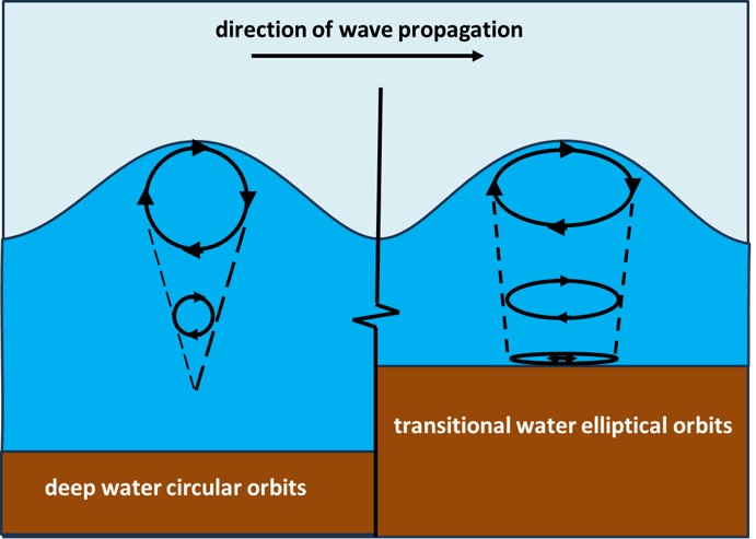
| 21:38, 2 June 2024 | WaveOrbits.jpg (file) |  |
49 KB | Dronkers J | Particle displacements for deep and transitional waves. | 1 |
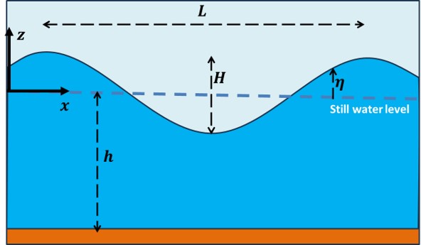
| 20:50, 2 June 2024 | DefSinusWave.jpg (file) |  |
25 KB | Dronkers J | Definition sketch for a sinusoidal wave. | 1 |
| 16:13, 23 May 2024 | CoveTGroinMorph.jpg (file) |  |
40 KB | Dronkers J | Equilibrium morphology of an artificial cove formed by T-groynes. | 1 |
| 22:05, 16 May 2024 | SeabedRipplesBahamas.jpg (file) |  |
147 KB | Dronkers J | Symmetrical ripples in biogenic, aragonitic sand (shallow subtidal seafloor just offshore from Sand Dollar Beach, nw San Salvador Island, eastern Bahamas). Photo credit James St. John. Creative Commons Licence | 1 |
| 22:04, 16 May 2024 | RiverBedRipplesKennetcookRiver.jpg (file) |  |
288 KB | Dronkers J | Current-generated linguoid ripples, Kennetcook River, Nova Scotia, Canada. Photo credit J. Waldron https://sites.ualberta.ca/~jwaldron/ | 1 |
| 22:03, 16 May 2024 | CurrentRipplesMSM.jpg (file) |  |
103 KB | Dronkers J | Current ripples in a fine-sediment channel bed, Baie du Mont Saint Michel. | 1 |
| 22:02, 16 May 2024 | AntidunesWillametteRiver.jpg (file) |  |
139 KB | Dronkers J | Antidunes in the Willamette River (USA). Photo credit Marli Miller. https://geologypics.com/ | 1 |
| 17:51, 16 May 2024 | BedformDiagram.jpg (file) |  |
122 KB | Dronkers J | Bedform stability diagram for unidirectional currents. Redrawn after Southard and Boguchwal (1990). | 1 |
| 11:52, 16 May 2024 | RippleModels.jpg (file) |  |
423 KB | Dronkers J | Empirical ripple prediction formulas. Left: Predictions of the ripple height. Right: Predictions of the ripple wavelength. | 2 |
| 11:39, 10 May 2024 | DAPPScheme.jpg (file) |  |
81 KB | Dronkers J | Steps of the Dynamic Adaptation Policy Pathways approach. From Haasnoot et al. (2013) | 2 |
| 17:42, 4 May 2024 | MytilicultureSaintMichel.jpg (file) |  |
348 KB | Dronkers J | Mussel farm in Baie du Mont Saint Michel (France). Mussel cultivating takes place on poles (bouchots) drilled deep into the seabed. For seed collection, a coconut fiber rope is wrapped in a spiral around the post. When time comes for grow-out, a nettin... | 1 |
| 16:23, 28 April 2024 | DepositionFluxFlocs.jpg (file) |  |
74 KB | Dronkers J | Deposition flux of flocculated sediment from the San Francisco Bay tested in a flume. Modified from Mehta et al. (2014) | 2 |
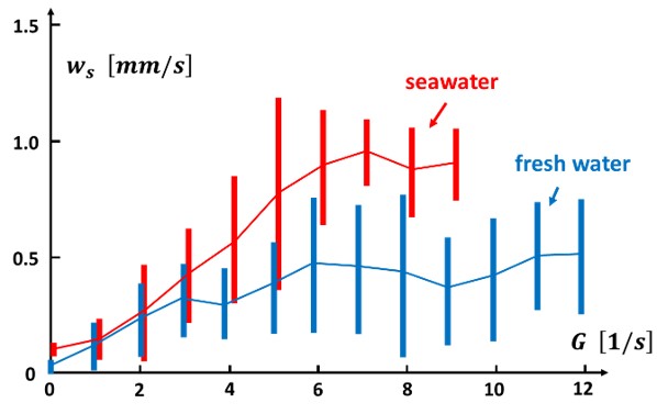
| 10:14, 28 April 2024 | SettlingvelocityBarataria.jpg (file) |  |
34 KB | Dronkers J | Settling velocity as function of the velocity shear rate measured in Barataria basin (USA Gulf coast). Redrawn after McDonell et al. (2024). | 1 |
| 17:02, 27 April 2024 | OsmosisProcess.jpg (file) |  |
203 KB | Dronkers J | Osmosis through a semi-permeable membrane that allows passage of solvent molecules (blue) while blocking the passage of solute molecules (red). | 2 |
| 13:23, 22 April 2024 | Lysocline.jpg (file) |  |
53 KB | Dronkers J | Zones of calcite and aragonite dissolution. Redrawn after Harris et al. (2023). | 1 |
| 19:55, 15 April 2024 | RippleRegimeTransportCompressed.gif (file) | 1.9 MB | Dronkers J | Wave-induced sand transport over a seabed ripple. Courtesy Jebbe van der Werf. | 1 | |
| 17:59, 6 April 2024 | BeachClassification.jpg (file) |  |
51 KB | Dronkers J | Beach morphologies according to the parameters <math>\Omega</math> and <math>RTR</math>. Reflective beaches are found in the red zone and dissipative beaches in the blue zone. | 2 |
| 14:34, 4 April 2024 | MangroveRootSystems.jpg (file) |  |
82 KB | Dronkers J | Mangrove root systems. Avicennia, Rhizophora and Bruguiera, from left to right, after Marchand (2008) | 1 |
| 16:23, 1 April 2024 | BeachRockBrazil.jpg (file) |  |
194 KB | Dronkers J | Beachrock along the Brazilian coast. | 1 |
| 14:48, 30 March 2024 | PontoonBreakwaters.jpg (file) |  |
96 KB | Dronkers J | Different types of pontoon breakwaters. | 1 |
| 20:16, 28 March 2024 | SubmergedBreakwaterErosionSedimentation.jpg (file) |  |
54 KB | Dronkers J | Flow circulation patterns behind a submerged breakwater for shore-normal wave incidence. Beach erosion or beach accretion may occur depending on the type of circulation pattern. | 1 |
| 21:34, 26 March 2024 | ColumnRevetment.jpg (file) |  |
255 KB | Dronkers J | Column revetment of Marazion sea wall, Cornwall, United Kingdom. Credit: Charles Gould. Licensed under Creative Commons | 1 |
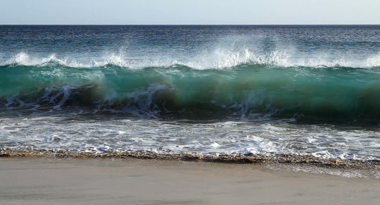
| 19:09, 27 February 2024 | WavePlungeLipari.jpg (file) |  |
175 KB | Dronkers J | Plunging wave, still from the video by Vincentz 2013 https://zenodo.org/records/8070591 under licence CC Y-SA (attribution and share-alike). | 1 |
| 17:08, 23 February 2024 | PsephurusGladius.jpg (file) |  |
319 KB | Dronkers J | The Chinese paddlefish (''Psephurus gladius''). Image public domain. | 1 |
| 11:56, 23 February 2024 | WavePlunge.jpg (file) |  |
94 KB | Dronkers J | Plunging wave, still from the video by Vincentz 2013 https://zenodo.org/records/8070591 under licence CC Y-SA (attribution and share-alike). | 1 |
| 19:03, 22 February 2024 | ArcticIceCover.jpg (file) |  |
77 KB | Dronkers J | Arctic sea ice extent for several years between 2012 and 2024 compared to the average extent over the period 1981-2010. The gray areas around the median line show the interquartile and interdecile ranges of the data. Image credit National Snow and Ice... | 1 |
| 17:59, 16 February 2024 | Gabion-hengistbury-head.JPG (file) |  |
231 KB | Dronkers J | Picture of Gabions at hengistbury head. Taken by teacher (Mr. grice) and uploaded by en:User:Lmc169 |Source=Originally from [http://en.wikipedia.org en.wikipedia]; description page is/was [http://en.wikipedia.org/w/index.ph | 1 |
| 12:59, 16 February 2024 | CoastalErosionSophieDay.png (file) |  |
211 KB | Dronkers J | Coastal erosion, England. Photo credit Sophie Day. Creative Commons Licence. https://www.weforum.org/agenda/2022/10/coastal-erosion-environment-uk-climate/ | 1 |
| 15:43, 14 February 2024 | NorthSeaEmodnet.jpg (file) |  |
104 KB | Dronkers J | North Sea bathymetry. From [https://www.marineregions.org/gazetteer.php?p=image&pic=115811 EMODNET] Creative Commons licence | 1 |
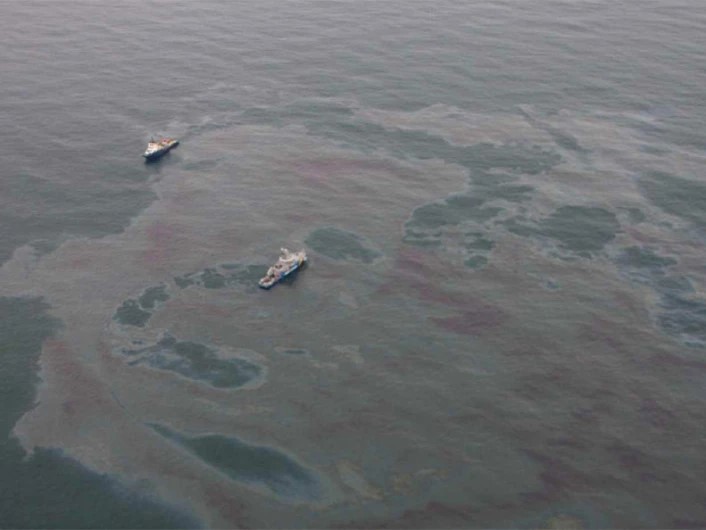
| 22:05, 8 February 2024 | OilSlick.jpg (file) |  |
53 KB | Dronkers J | Aerial image of an oil slick. Photo credit The Norwegian Coastal Administration/NOFO/Sundt Air. https://www.sciencenorway.no/environmental-protection-environmental-technology-forskningno/detecting-oil-spills-with-satellite/1460647 | 1 |
| 18:23, 6 February 2024 | WaddenOilSpill.jpg (file) |  |
185 KB | Dronkers J | Numerical simulation of oil spill locations 5 days after hypothetical oil releases on 15th of March 2008 at 04:00 UTC from a black oil tanker and a blue oil tanker. Dashed spills are mixed over the water column by dispersant application. Full black and... | 1 |
| 17:44, 4 February 2024 | EuropeanShagChristophMoning.jpg (file) |  |
250 KB | Dronkers J | European shag (''Gulosus aristotelis''). Photo credit Christoph Monin [https://ebird.org/science/status-and-trends ebird.org] | 1 |