File list
This special page shows all uploaded files.
| Date | Name | Thumbnail | Size | User | Description | Versions |
|---|---|---|---|---|---|---|
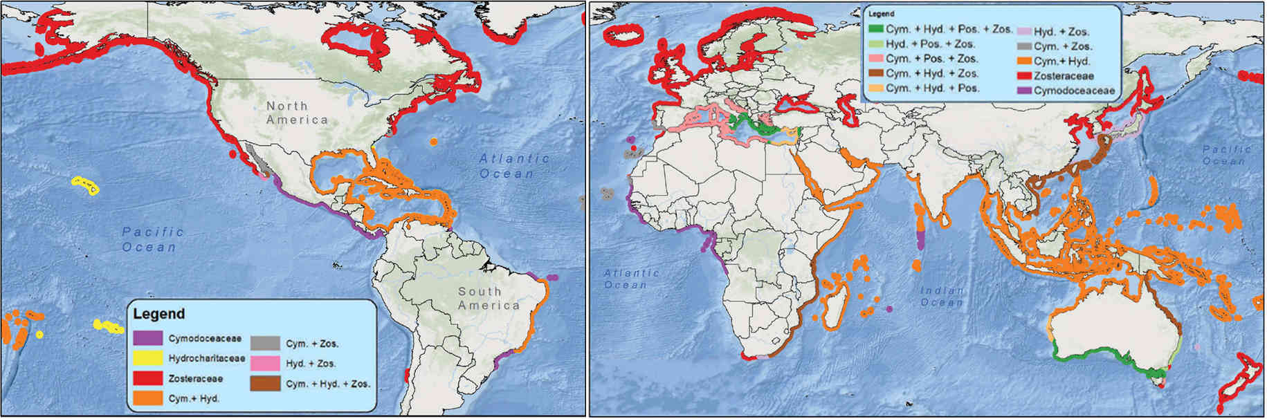
| 11:11, 9 February 2026 | SeagrassGlobalDistribution.jpg (file) |  |
129 KB | Dronkers J | Global distribution of seagrass species. Data Source: IUCN, Map created by T. Bakirman. https://doi.org/10.1080/22797254.2018.1544838 Creative Commons Licence. | 1 |
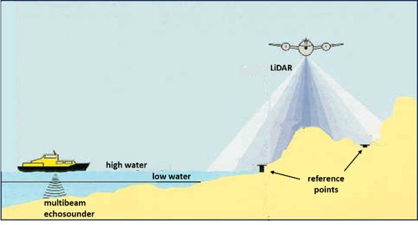
| 10:41, 7 February 2026 | BeachMonitoring.jpg (file) |  |
26 KB | Dronkers J | Monitoring of the subaerial and submarine parts of the beach. | 1 |
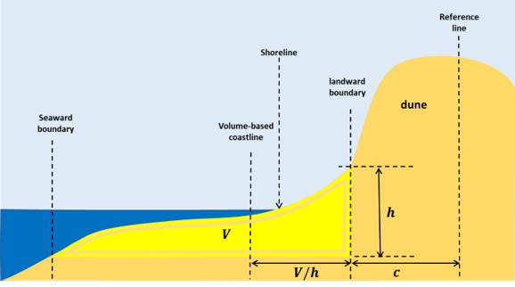
| 10:17, 7 February 2026 | VolCoastline.jpg (file) |  |
23 KB | Dronkers J | Coastline: a volume-based virtual shoreline | 1 |
| 11:19, 3 January 2026 | WaveTransformation.jpg (file) | 124 KB | Dronkers J | Illustration of terms related to the transformation of waves propagating to the shore. | 2 | |
| 11:00, 3 January 2026 | CoastalZonation.jpg (file) |  |
168 KB | Dronkers J | Definition of coastal sub-zones, adapted from the Shore Protection Manual, 1984 | 2 |
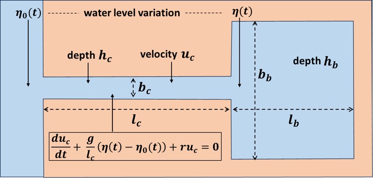
| 09:29, 22 December 2025 | HelmholzHarbor.jpg (file) |  |
45 KB | Dronkers J | Sketch of idealized harbor basin connected to the sea by a narrow channel. | 1 |
| 15:06, 20 December 2025 | GroundwaterTracer.jpg (file) |  |
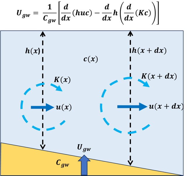
59 KB | Dronkers J | Determination of the total submarine groundwater discharge (fresh+salt) by measuring tracer concentrations <math>c(x)</math> and using the tracer balance equation. | 1 |
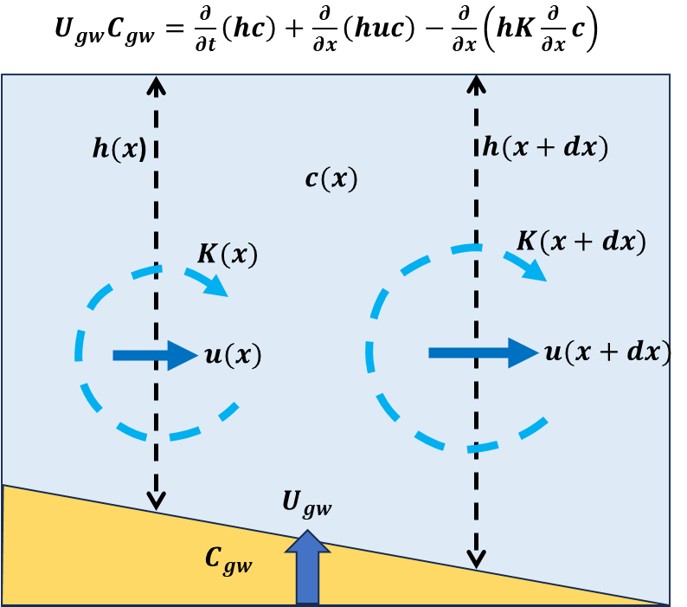
| 12:34, 14 December 2025 | GroundwaterTracerBalance.jpg (file) |  |
53 KB | Dronkers J | Determination of the SGD (fresh+salt) by measuring tracer concentrations <math>c(x)</math> and using the balance equation explained in the figure. | 1 |
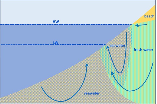
| 17:49, 9 December 2025 | BeachFreshSaltGroundwater.jpg (file) |  |
68 KB | Dronkers J | Schematic of beach groundwater circulation induced by the density difference between fresh groundwater runoff and infiltrating seawater. | 1 |
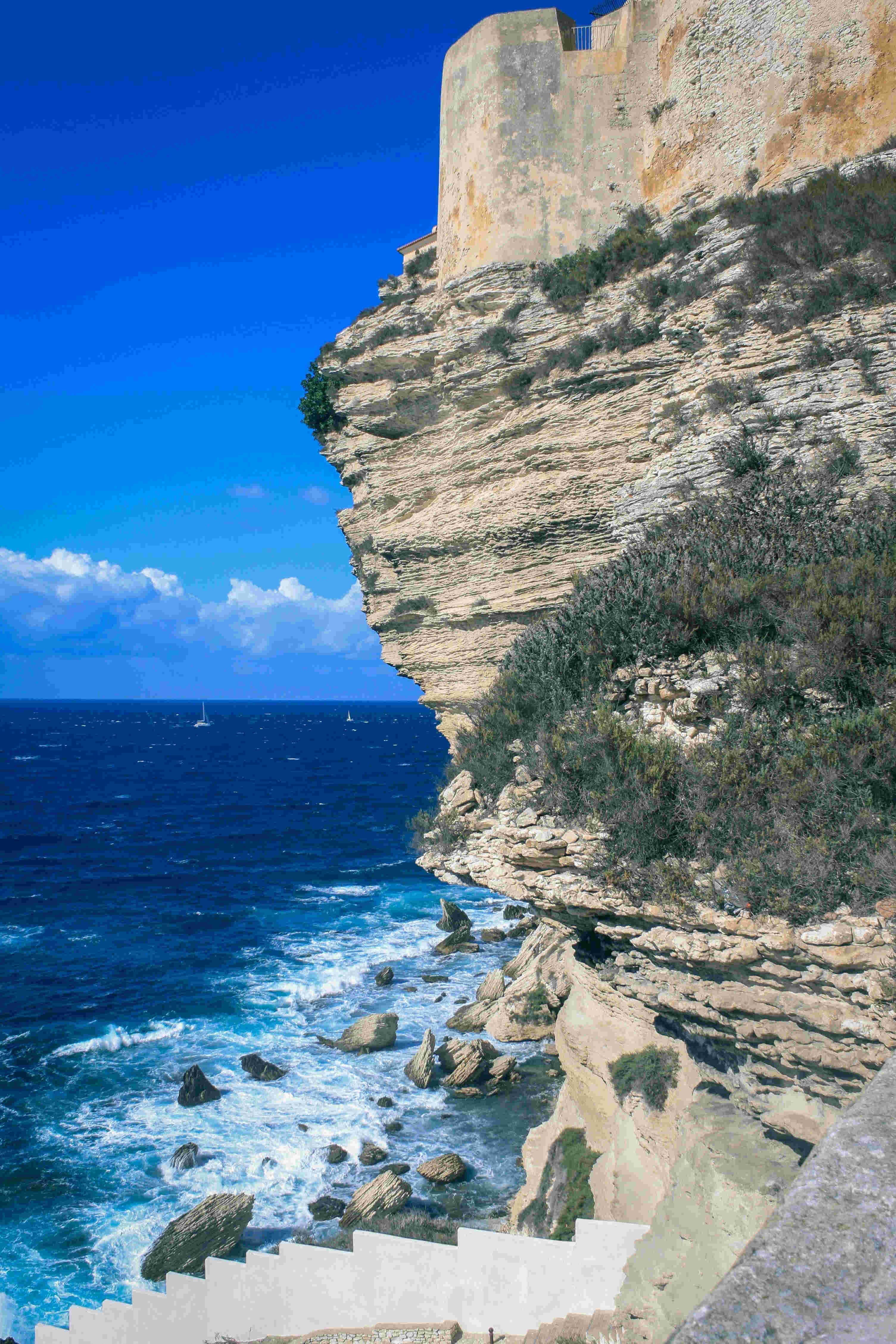
| 11:31, 7 December 2025 | CliffErosionBonifacio nejc-kosir.jpg (file) |  |
511 KB | Dronkers J | Erosion of a limestone cliff at Bonifacio, Corsica. Photo credit: Nejc Kosir. | 1 |
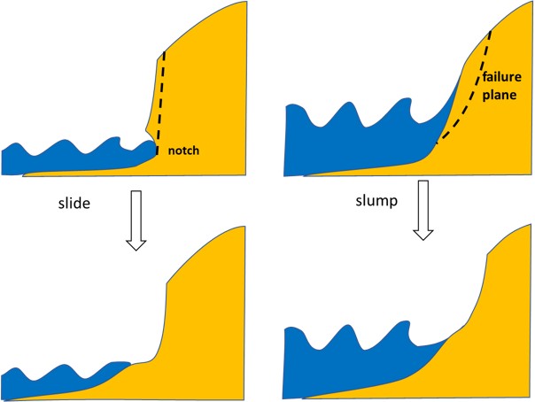
| 22:41, 29 November 2025 | DuneScarpMechanisms.jpg (file) |  |
34 KB | Dronkers J | Dune scarp mechanisms | 1 |
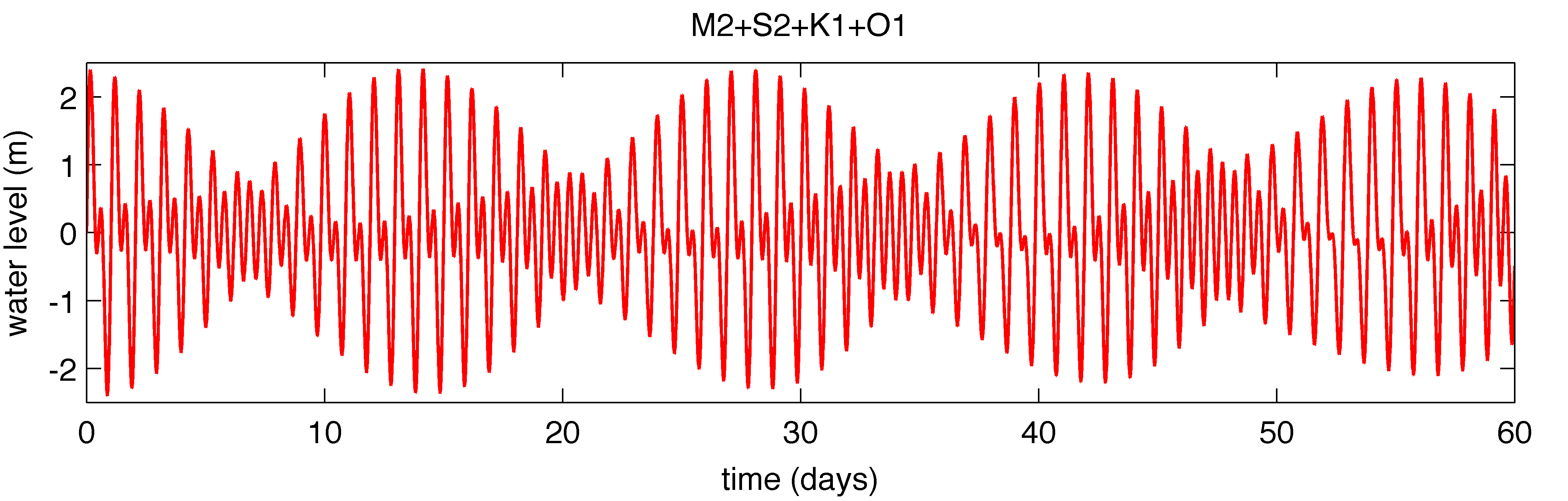
| 16:12, 20 November 2025 | Mixed cr.png (file) |  |
118 KB | Dronkers J | Tidal record of a mixed tide, with alternative dominance of the semidiurnal and diurnal components. | 1 |
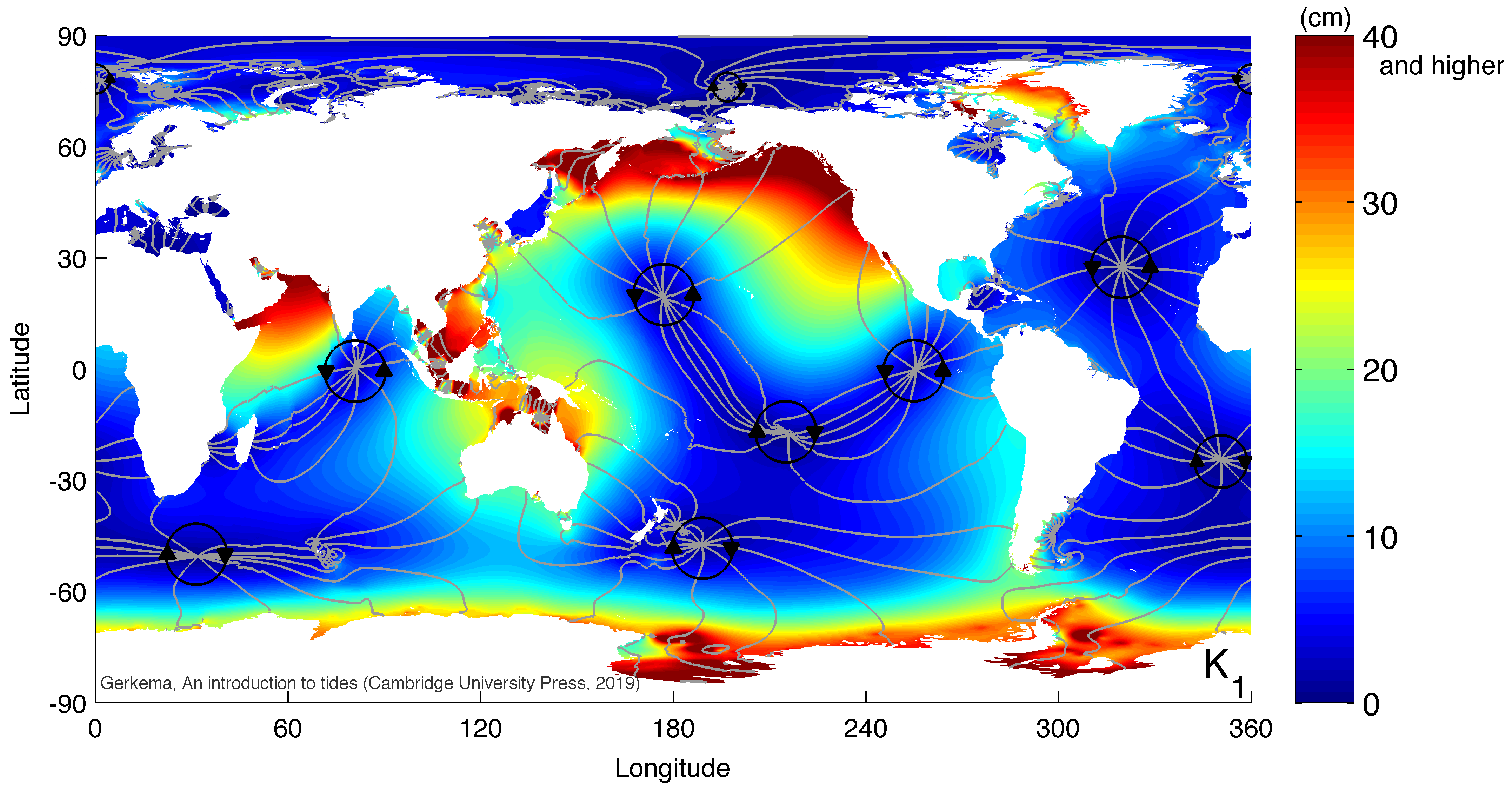
| 15:52, 20 November 2025 | Global K1 v2025 cr.png (file) |  |
959 KB | Dronkers J | Global map of the luni-solar declinational diurnal component K1. | 1 |
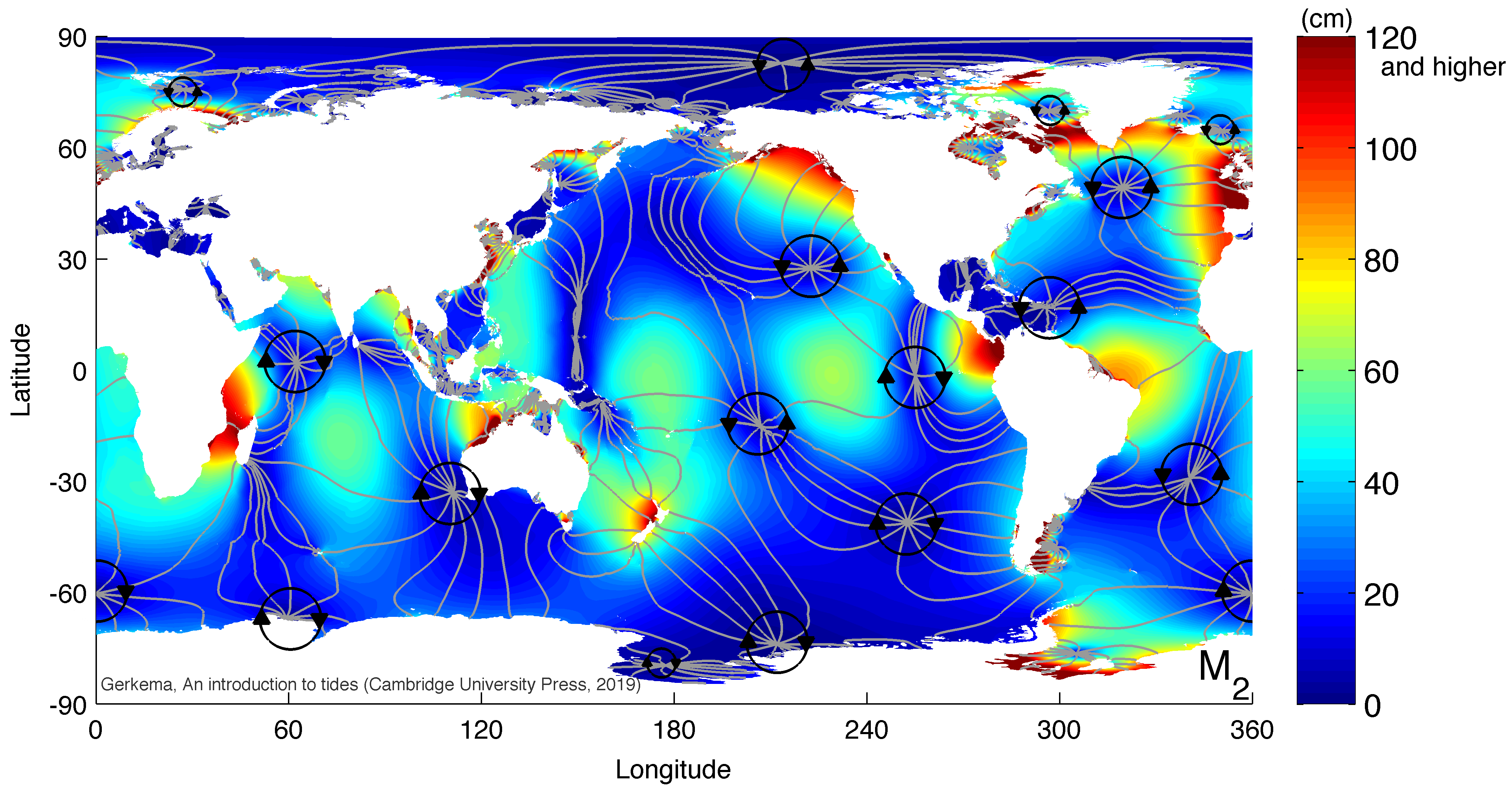
| 15:50, 20 November 2025 | Global M2 v2025 cr.png (file) |  |
1.04 MB | Dronkers J | Global map of the principal lunar semidiurnal component. | 1 |