Difference between revisions of "St Mawes"
From Coastal Wiki
| Line 11: | Line 11: | ||
:[https://www.google.co.uk/search?q=St+Mawes+fishing+port&tbm=isch Images of St Mawes] | :[https://www.google.co.uk/search?q=St+Mawes+fishing+port&tbm=isch Images of St Mawes] | ||
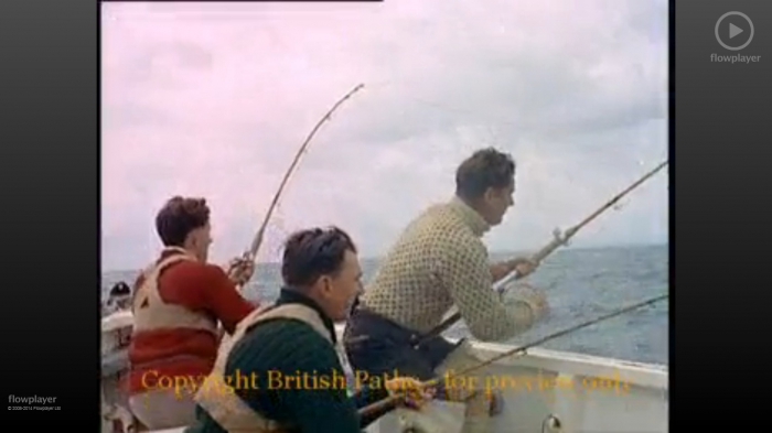
| − | <img width=" | + | <img width="350" height="197" style="border-width: 0px;" title="Shark Fishing in St. Mawes (1958)" alt="Shark Fishing in St. Mawes (1958)" src="http://images.vliz.be/resized/103004_shark-fishing-in-st-mawes-1958.jpg"> |
:'''Video''': [http://www.britishpathe.com/video/shark-fishing/query/st+mawes Shark Fishing in St. Mawes (1958)]. | :'''Video''': [http://www.britishpathe.com/video/shark-fishing/query/st+mawes Shark Fishing in St. Mawes (1958)]. | ||
Revision as of 14:52, 13 October 2014
St Mawes
- Administrative Port: Newlyn
- County: Cornwall
- Population: 714
St Mawes is a small town on the Roseland Peninsula on the south coast of Cornwall, England. It has an immense natural harbour, often claimed to be the third largest in the world. It was once a busy fishing port, but the trade declined during the 20th century. It is now a popular tourist location, with many properties in the town being holiday accommodation or "second homes".

| Background information | |||
|---|---|---|---|
| Fishing Fleet | Vessel type 1 | 11 | |
| Fishing Fleet | Vessel type 2 | 0 | |
| Fishing Fleet | Vessel type 3 | ||
| Fishing Fleet | Vessels total | 11 | |
| Landings | Total Landings (tonnes) | Demersal (tonnes) | |
| Landings | Total Landings (tonnes) | Pelagic (tonnes) | |
| Landings | Total Landings (tonnes) | Shellfish (tonnes) | |
| Landings | Total Landings (tonnes) | Main species (tonnes) | |
| Landings | Total Landings (tonnes) | All species (tonnes) | |
| Landings | Values | Demersal | |
| Landings | Values | Pelagic | |
| Landings | Values | Shellfish | |
| Landings | Values | All species | |
| Landings | Number of fishermen | Number of fishermen (Regular) | |
| Landings | Number of fishermen | Number of fishermen (Part-time) | |
| Landings | Number of fishermen | Number of fishermen Total | |
| Landings | Major fish species | ||
| Landings | Landing points | ||
| Landings | Location of auctions | ||
| Governance and organisation | Governance | St Mawes FLAG | |
| Governance and organisation | FLAG | Cornwall | |
| Governance and organisation | Location of fishermen's organisations | St Mawes & District Fishermen's Association | |
| Branding | Brand labels | ||
| Fish as food | Fish selling | Fish shop on Quay: St Mawes Seafood, St Mawes Quay, Cornwall | |
| Fish as food | Fish processing | ||
| Fish as food | Restaurants/hotels | ||
| Tourism & Education | Tourism & Fishing | Fishing Trips: Fish and Trips | |
| Tourism & Education | Festivals | St Mawes Fish Festival | |
| Tourism & Education | Fishing museums | ||
| Tourism & Education | Aquariums | ||
| Tourism & Education | Monuments | ||
| Tourism&Education | Fishing training School | ||
- Vessel type 1: <10 m vessels
- Vessel type 2: >10 m vessels
References
1. http://www.marinemanagement.org.uk/fisheries/statistics/vessel.htm Feb 2014
