Difference between revisions of "Geographical Information System"
From Coastal Wiki
Ulriklumborg (talk | contribs) m |
|||
| Line 1: | Line 1: | ||
| − | Geographical Information System | + | Geographical Information System (GIS) is a tool for analysis and presentation of spatial data. It is a collection of computer hardware, software and geographic data for capturing, managing, analyzing and displaying all forms of geographically references information. |
| − | + | ==What is GIS?== | |
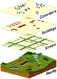
| + | ;Simple definition : A Geographic Information System organizes large volumes of raw data into a map form for easy comprehension. | ||
| + | :GIS divides raw data into layers so it can give you a better understanding for the whole world. | ||
| + | |||
| + | [[Image:GISdefinition.jpg]] | ||
| + | |||
| + | ==Why is GIS unique?== | ||
| + | *GIS handles SPATIAL information | ||
| + | **Information referenced by its location in space | ||
| + | [Image:Spatialinfo.jpg]] | ||
| + | |||
| + | ==GIS functions== | ||
| + | *Data input | ||
| + | *Storage | ||
| + | *Management | ||
| + | *Analysis | ||
| + | *Output | ||
| + | |||
| + | ===Storing data using Geodatabase=== | ||
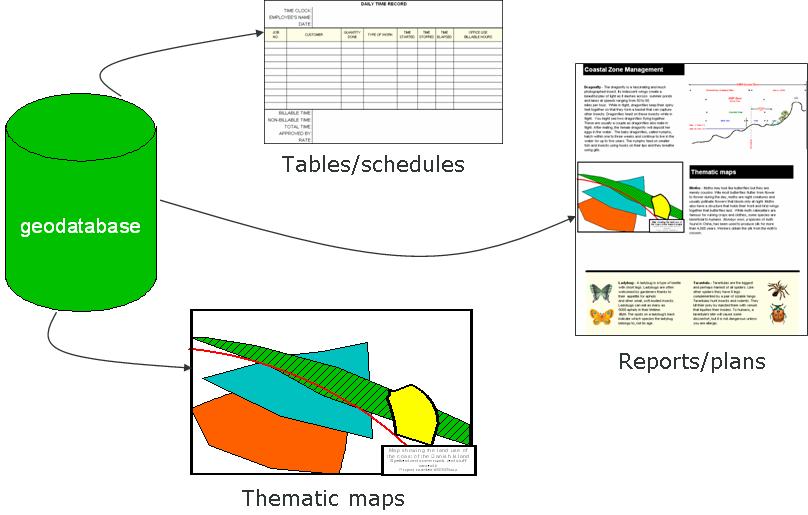
| + | *Geodatabase is a container for spatial and non- spatial data that can be organized in a certain structure. | ||
| + | *Advantages: | ||
| + | **provide a single, consolidated data storage for field measurements and all types of data used. | ||
| + | **Controlling data entry by applying validation rule on the attributes. | ||
| + | |||
| + | [[Image:Geodatabase.jpg]] | ||
| + | |||
| + | ==CZM and GIS== | ||
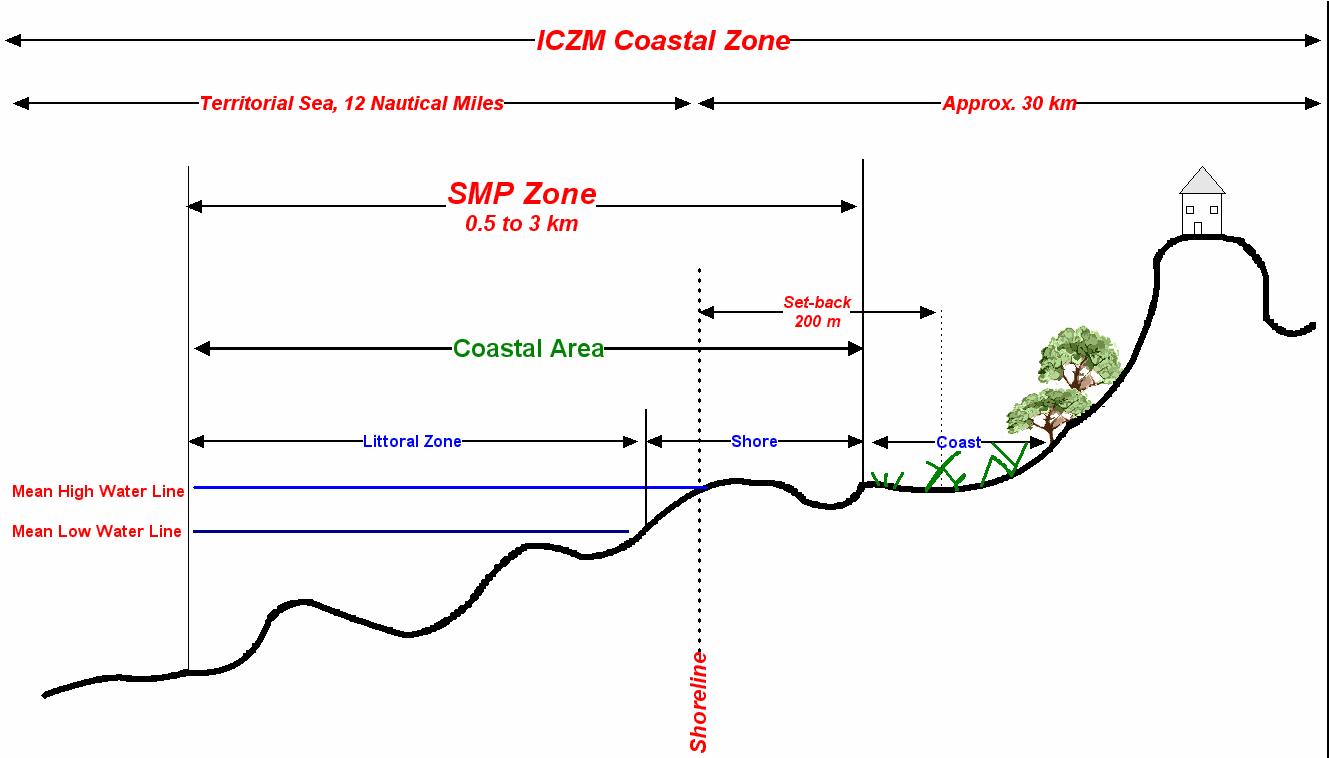
| + | *GIS stores all data relevant for the CZM | ||
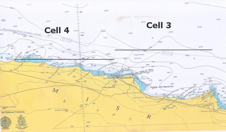
| + | *GIS handles data on all spatial scales (North Egypt coast vs. a single harbour) | ||
| + | *GIS is a powerful analysis tool. | ||
| + | **Comparison of measurements from different years | ||
| + | **Overlay analysis of measurements and modelling results | ||
| + | [[Image:GISCZM.jpg]] | ||
| + | [[Image:GISCZM2.jpg]] | ||
| + | |||
| + | ==Data types== | ||
| + | *DFS2 Data MIKE 21 | ||
| + | *Dfs1 Data MIKE 21 | ||
| + | *XYZ Data | ||
| + | *Wave time series & Rose | ||
| + | *Scanned Maps | ||
| + | *CAD drawing | ||
| + | '''Additional Data''' | ||
| + | *Land use | ||
| + | *Sediment classification | ||
| + | *Satellite images | ||
| + | *Geographical maps | ||
| + | *Reports (design, licenses, Site investigation) | ||
| + | *….etc. | ||
Revision as of 13:09, 8 January 2007
Geographical Information System (GIS) is a tool for analysis and presentation of spatial data. It is a collection of computer hardware, software and geographic data for capturing, managing, analyzing and displaying all forms of geographically references information.
Contents
What is GIS?
- Simple definition
- A Geographic Information System organizes large volumes of raw data into a map form for easy comprehension.
- GIS divides raw data into layers so it can give you a better understanding for the whole world.
Why is GIS unique?
- GIS handles SPATIAL information
- Information referenced by its location in space
[Image:Spatialinfo.jpg]]
GIS functions
- Data input
- Storage
- Management
- Analysis
- Output
Storing data using Geodatabase
- Geodatabase is a container for spatial and non- spatial data that can be organized in a certain structure.
- Advantages:
- provide a single, consolidated data storage for field measurements and all types of data used.
- Controlling data entry by applying validation rule on the attributes.
CZM and GIS
- GIS stores all data relevant for the CZM
- GIS handles data on all spatial scales (North Egypt coast vs. a single harbour)
- GIS is a powerful analysis tool.
- Comparison of measurements from different years
- Overlay analysis of measurements and modelling results
Data types
- DFS2 Data MIKE 21
- Dfs1 Data MIKE 21
- XYZ Data
- Wave time series & Rose
- Scanned Maps
- CAD drawing
Additional Data
- Land use
- Sediment classification
- Satellite images
- Geographical maps
- Reports (design, licenses, Site investigation)
- ….etc.


