Difference between revisions of "Danube Delta"
| Line 9: | Line 9: | ||
<u>'''ICZM phase'''</u> | <u>'''ICZM phase'''</u> | ||
| − | Establishment | + | [[ICZM_Process_diagram/Establishment|Establishment]] |
<br style="clear:both;"/> | <br style="clear:both;"/> | ||
[[Image:danube_delta1.jpg|300px|thumb|right|Sakhalin island (Author:Paul Goriup)]] | [[Image:danube_delta1.jpg|300px|thumb|right|Sakhalin island (Author:Paul Goriup)]] | ||
Revision as of 09:54, 14 July 2011
CASE description
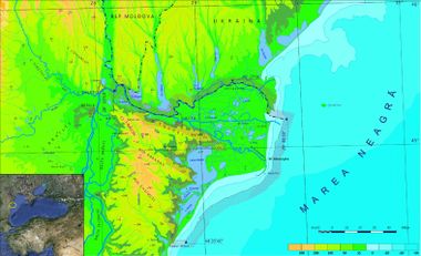
The coast of Danube Delta (Romania) comprised between Musura branch and Midia cape in South (166 km) is characterized by sandy beaches and low altitudes less steep underwater slopes.
ICZM phase
Main coastal issues
- Habitat degradation
- Loss of biodiversity
- Erosion
- Impacts on population livelihood and wellbeing
Objectives
- Improvement of coastal ecosystem knowledge
- Biodiversity conservation
- Regulation of economical activities on ecological bases
End Products
- Creation of a database for ICZM
- Development of thematic maps
- Organisational design in the field of maritime spatial planning
- Elaboration of a preliminary ICZM strategy
- Project proposal for new funding
Tools foreseen to be developed and used
Indicators - LEAC - Scenarios - Participatory methods.
Other tools to be applied
SketchMetch method (Spatial planning tool)
Training needs
LEAC - Scenarios
CASE Responsible
Iulian Nichersu - Danube Delta national Institute for Research and Development, Tulcea - email: iuli@indd.tim.ro
Elaboration: Stefano Soriani, Fabrizia Buono, Monica Camuffo, Marco Tonino, University Ca’ Foscari of Venice.


