Difference between revisions of "Template:This weeks featured article"
From Coastal Wiki
| Line 1: | Line 1: | ||
'''Use of Lidar for coastal habitat mapping | '''Use of Lidar for coastal habitat mapping | ||
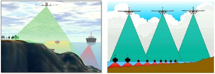
| − | [[ | + | [[image:lidar_fig_01.jpg|thumb|700px|right|Figure 2:Left panel from Banic & Cunningham (1998), right panel from Guenther et al. (2000)]] |
==Definition== | ==Definition== | ||
This article describes how Lidar (Laser or Light Detection and Ranging) can be used to collect data about coastal habitats. The article gives an introduction of the measurement principle and also explains how to plan for a Lidar-survey. More information about the conversion of collected data and the output of Lidar can be found in the article Data processing and output of Lidar. | This article describes how Lidar (Laser or Light Detection and Ranging) can be used to collect data about coastal habitats. The article gives an introduction of the measurement principle and also explains how to plan for a Lidar-survey. More information about the conversion of collected data and the output of Lidar can be found in the article Data processing and output of Lidar. | ||
| Line 9: | Line 9: | ||
Lidar (Laser Induced Detection And Ranging ou LIght Detection And Ranging) is an active [[remote sensing]] | Lidar (Laser Induced Detection And Ranging ou LIght Detection And Ranging) is an active [[remote sensing]] | ||
| − | + | ||
technique using light emission. Part of the light is diffused or absorbed by the environment and the other part is backscattered in the direction of the source of radiation. The time difference... | technique using light emission. Part of the light is diffused or absorbed by the environment and the other part is backscattered in the direction of the source of radiation. The time difference... | ||
Revision as of 15:38, 16 December 2010
Use of Lidar for coastal habitat mapping
Definition
This article describes how Lidar (Laser or Light Detection and Ranging) can be used to collect data about coastal habitats. The article gives an introduction of the measurement principle and also explains how to plan for a Lidar-survey. More information about the conversion of collected data and the output of Lidar can be found in the article Data processing and output of Lidar.
Introduction
Lidar (Laser Induced Detection And Ranging ou LIght Detection And Ranging) is an active remote sensing
technique using light emission. Part of the light is diffused or absorbed by the environment and the other part is backscattered in the direction of the source of radiation. The time difference...
