Difference between revisions of "Template:This weeks featured article"
From Coastal Wiki
(→Monitoring coastal morphodynamics using high-precision multibeam technology) |
(US Army Corps of Engineers’ Coastal Programs) |
||
| Line 1: | Line 1: | ||
| − | == | + | ==US Army Corps of Engineers’ Coastal Programs== |
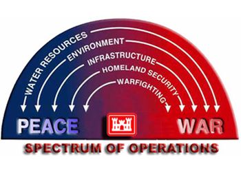
| − | [[Image: | + | [[Image:USACE.jpg|thumb|350px|center|Figure 1: The United States Army Corps of Engineers (USACE) serves the Armed Forces and the Nation by providing vital engineering services and capabilities.]] |
| − | + | The US Army Corps of Engineers (USACE) <ref>USACE Website http://www.usace.army.mil/</ref> is a federal agency within the Department of Defense mandated to provide both military and civil works services. In coastal regions, its primary roles include protecting and [[Overview of Coastal Habitat Protection and Restoration in the United States|restoring habitat]], maintaining navigable waters, conducting [[beach nourishment]], undertaking [[Flood (overflow)| flood control]] projects and regulating coastal restoration projects. | |
| − | + | The USACE’s military service dates to 1775. Its first water works project began in 1812. After the passage of the Rivers & Harbors Act of 1899, the USACE regulated activities in navigable waterways. Passage of the [http://www.epa.gov/watertrain/cwa/| Clean Water Act] in 1972 vastly increased the USACE’s authority over dredging and filling in waters and wetlands. The Corps is the lead federal flood control agency and a major provider of hydroelectric energy. In the late 1960s, the Corps became a leading environmental preservation and restoration agency. It is a leading partner in one of the largest restoration projects ever attempted—restoration of the hydrologic regime in the Florida Everglades. | |
| − | |||
Revision as of 10:44, 2 March 2009
US Army Corps of Engineers’ Coastal Programs
The US Army Corps of Engineers (USACE) [1] is a federal agency within the Department of Defense mandated to provide both military and civil works services. In coastal regions, its primary roles include protecting and restoring habitat, maintaining navigable waters, conducting beach nourishment, undertaking flood control projects and regulating coastal restoration projects.
The USACE’s military service dates to 1775. Its first water works project began in 1812. After the passage of the Rivers & Harbors Act of 1899, the USACE regulated activities in navigable waterways. Passage of the Clean Water Act in 1972 vastly increased the USACE’s authority over dredging and filling in waters and wetlands. The Corps is the lead federal flood control agency and a major provider of hydroelectric energy. In the late 1960s, the Corps became a leading environmental preservation and restoration agency. It is a leading partner in one of the largest restoration projects ever attempted—restoration of the hydrologic regime in the Florida Everglades.- ↑ USACE Website http://www.usace.army.mil/
